Markus SkogsmoCEO of PandionAImso@pandionai.com

Olof JohanssonCTO of PandionAIojo@pandionai.com
At PandionAI we deliver global timely alerts and actionable information from satellite data, providing your organization with limitless insights that seamlessly integrate with your systems for faster and more informed decision-making at minimal cost.
Tailored AI-driven analysis of Earth Observation (EO) data, providing insights specific to each customer's needs
Sophisticated AI/ML algorithms for object detection and analysis of satellite images. Applicable to existing satellite data
Unique and effective information flow for optimizing customer requests and data handling

Delivering exactly the information requested, integrated directly into the customer's decision-making system
Comprehensive solution encompassing data processing, analysis, and customer integration
PandionAI's AlertSat system transforms satellite data into actionable insights across diverse industries. From land-use monitoring to infrastructure management and maritime surveillance, our AI-driven analysis delivers timely, targeted information. Discover how our tailored solutions can revolutionize your operations and provide critical intelligence when you need it most.

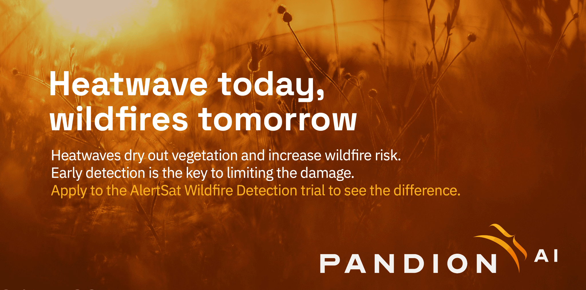
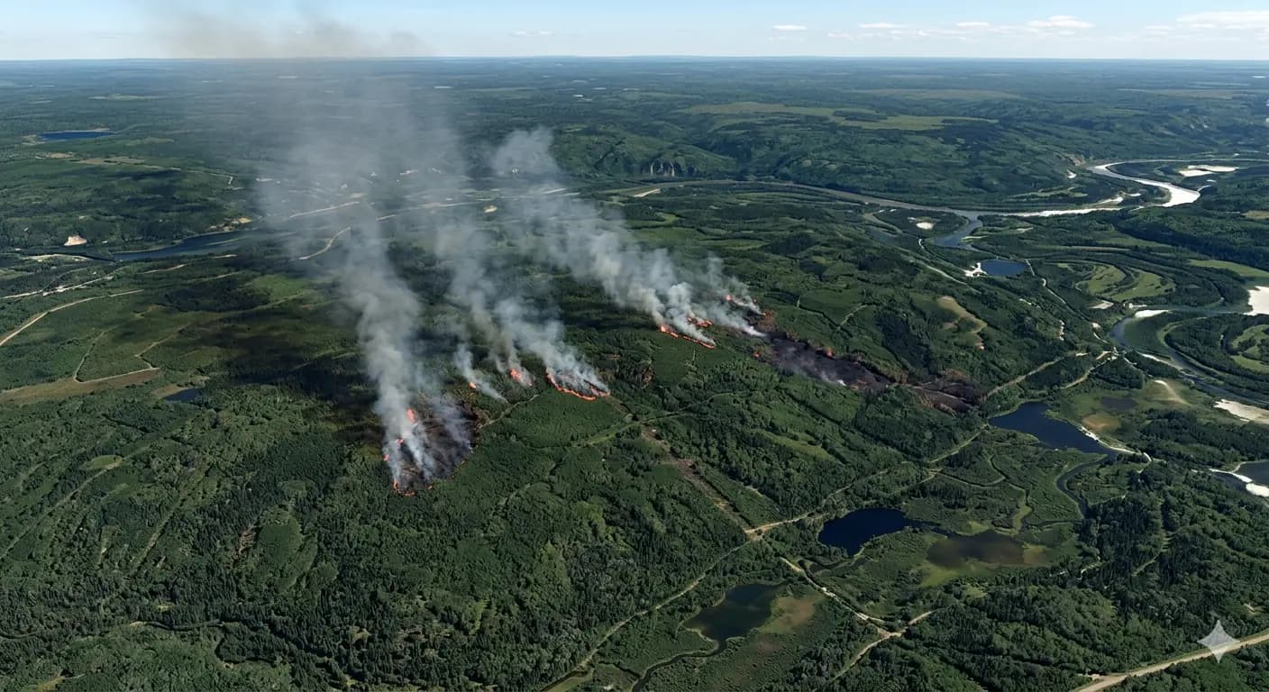
Early detection and monitoring of wildfires to save lives, protect resources, and minimize economic losses. Our Alerts provide crucial information to firefighting teams, including firefront location, extent, and wind direction.

Timely alerts on road conditions and potential hazards for large-scale construction projects. We help logistics teams identify risks like landslides or flooded areas, ensuring smooth operations and preventing costly delays.

Detection of dark vessels and illegal fishing activities to protect marine ecosystems and support sustainable ocean management. Our system helps authorities combat maritime crimes and enforce regulations.
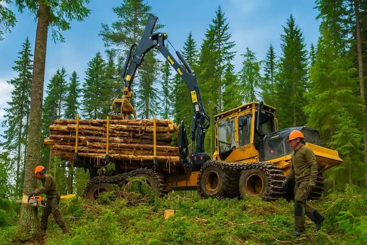
Changes in forest health and growth usually occur gradually, often going unnoticed between surveys, especially in remote or large areas. Relying solely on periodic inspections and partial data makes it hard to maintain an accurate, up-to-date view of forest resources.
Stay informed with our customizable Alert System. Our non-proprietary approach ensures you can freely use and share the information we deliver, enabling rapid responses and informed decision-making without being locked into a closed ecosystem

The AlertSat Portal is your command center for harnessing the power of satellite intelligence. This user-friendly interface allows you to control and modify the applications to ensure your tailored AI empowerment. Key benefits include:

Our AlertSat GIS Plugin offers seamless integration for organizations using Geographic Information Systems (GIS) as their primary data management tool. It sends selected information directly to your GIS platform. Key benefits include:

PandionAI's advanced satellite intelligence solutions cater to a wide range of sectors, providing critical insights and timely alerts to drive informed decision-making.

Sustainable resource management, Crop and forest health monitoring, land use optimization and productivity assessment

Ecosystem and biodiversity monitoring, Climate risk and adaptation analysis, Sustainable resource management

Illegal fishing surveillance, Dark vessel detection, Coastal zone monitoring

Large-scale project monitoring, Risk assessment for transport routes, Natural hazard detection

Renewable energy site selection, Power plant construction monitoring, Energy infrastructure security

Property damage assessment, Climate change impact analysis, Infrastructure vulnerability mapping

Border surveillance, Disaster response and management, Urban planning and development
Got questions?
Let our experts guide you. Click below to connect!